
Traffic & transport
Strategise and deliver safer, more efficient transport systems.
How Planwisely can help your project
People Movement Data
See how people move through cities, towns and public spaces.
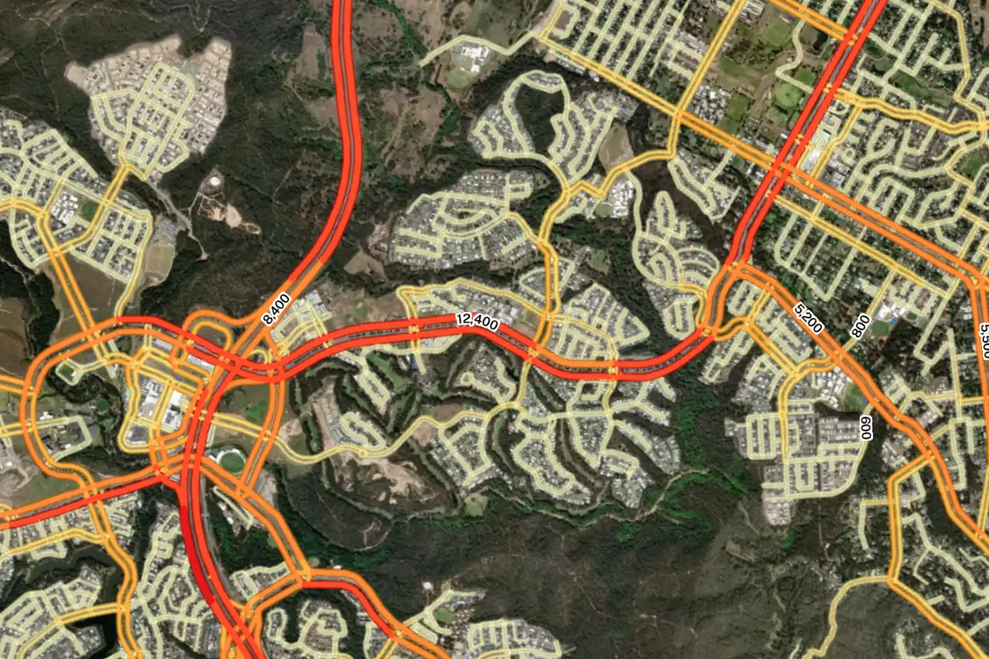
Road Traffic Data
Nationwide traffic volumes and link-level journey analysis.
Active Transport Planning
Visualise, analyse and predict walk and cycle travel patterns.
Combined Spatial Datasets
View multiple complex datasets to support your projects.
Deliver better outcomes today
Planwisely’s rich geospatial library and combination of clever tools and functions make it the perfect platform for:
Transport strategies and plans
Business cases
Cost/benefit analysis
Local Area Traffic Management (LATM) plans
Network planning (Movement and Place)
20-minute neighbourhoods, 30-minute cities and 45-minute regions
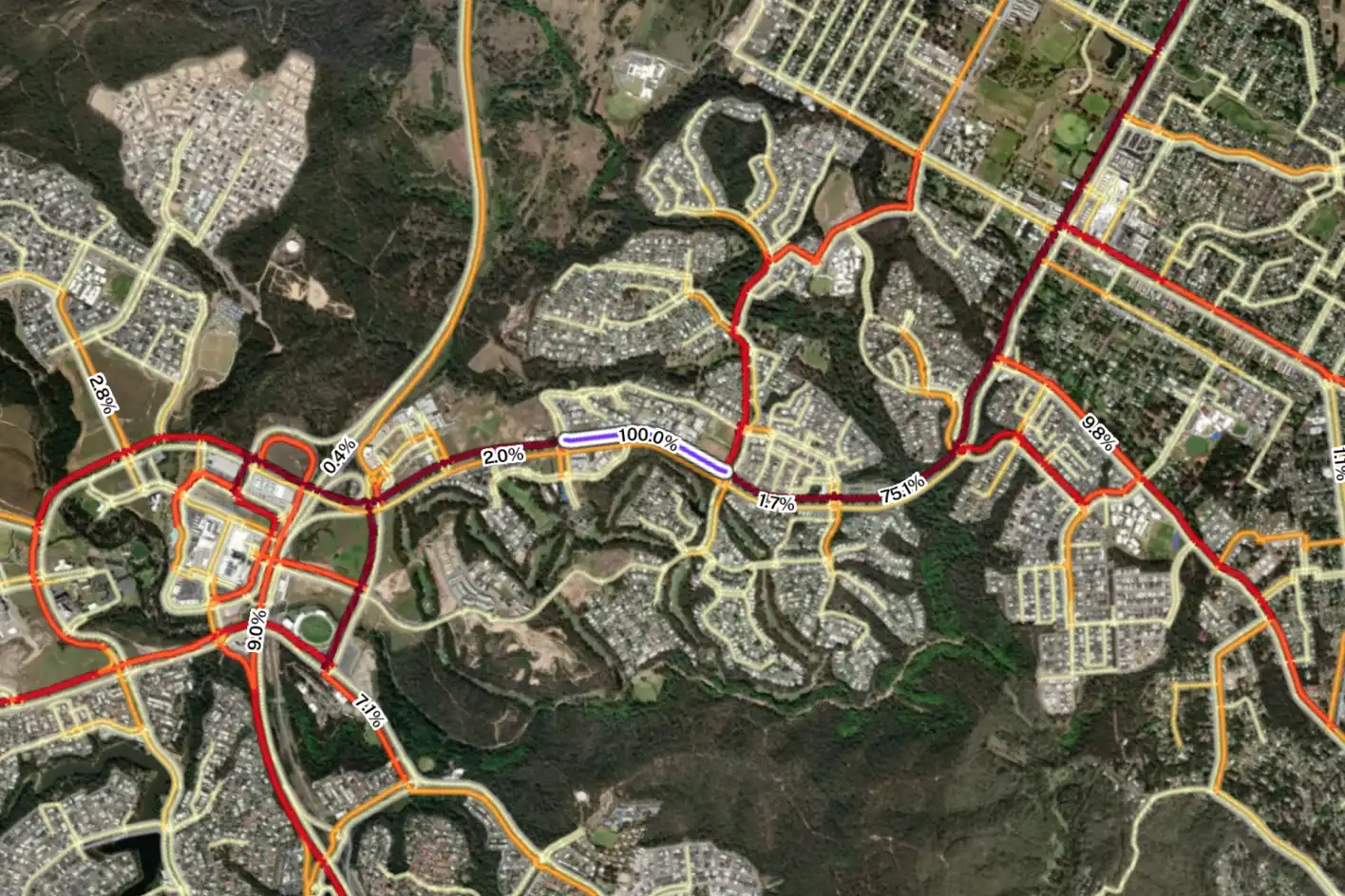
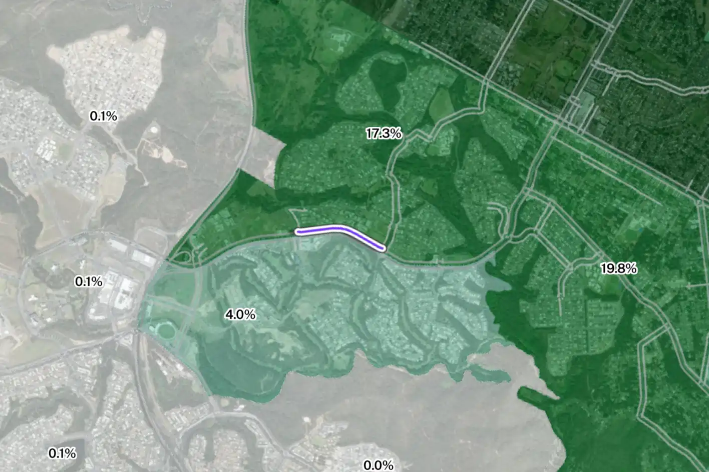
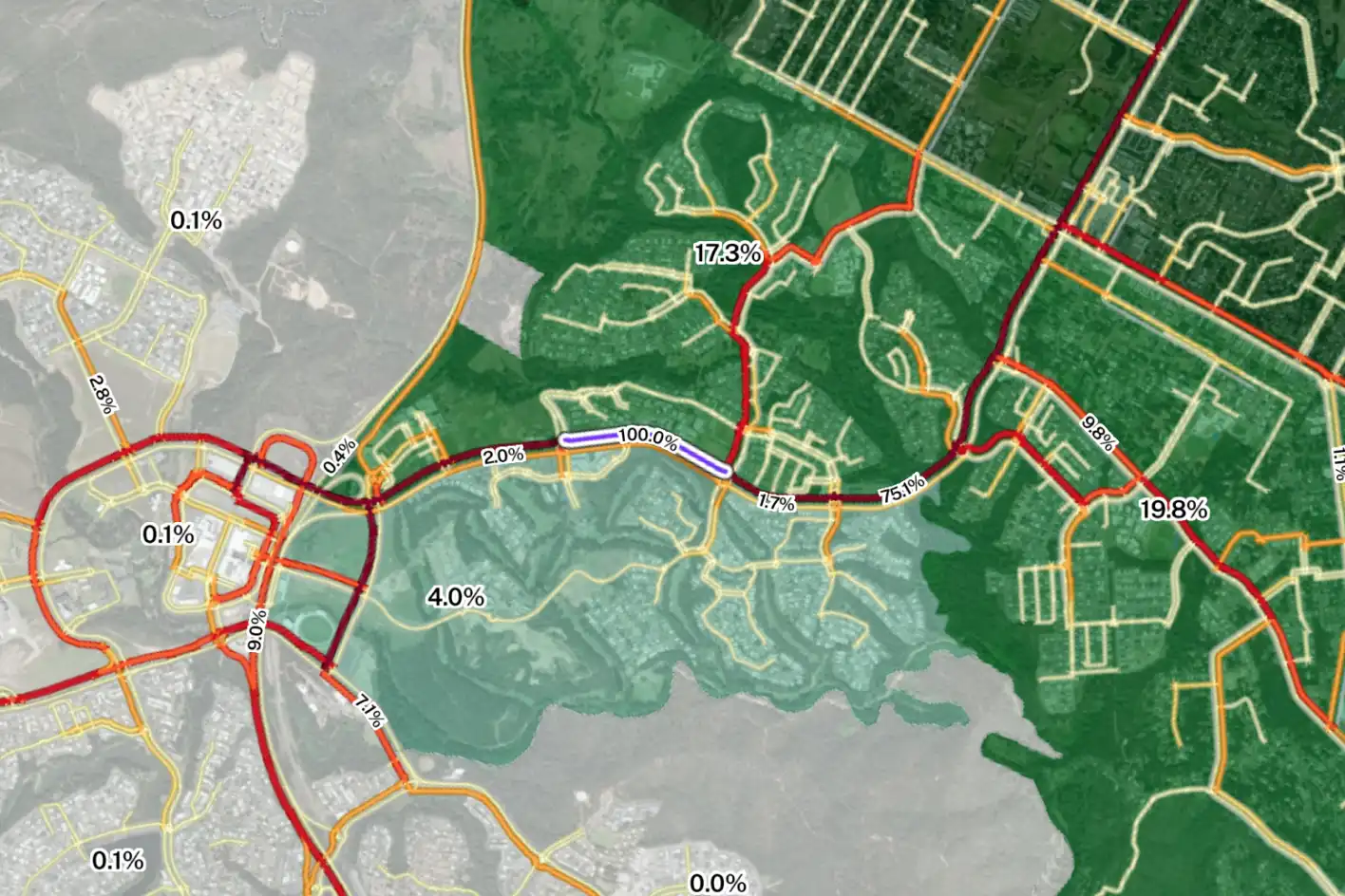
Uncover specific travel trends
Optimise your transport project by properly understanding people's travel patterns to and from an area.
Track visitation back to where journeys began - from an SA2 to an LGA level - to identify trends and understand how far people are travelling to reach a location. Plus, you can go even deeper by filtering by weekday, weekend or even by time of day.

Nationwide traffic volumes and journey analysis
Road Traffic Data enables government agencies to support network planning, corridor analysis, and early‑stage policy and investment decisions by combining nationwide traffic volumes with journey‑level insight across Australia’s road network.
Analyse where vehicles originate and where they travel next to better understand travel behaviour, network connectivity, and cross‑boundary movement.
Groundbreaking active transport planning
Analyse walk and cycle travel activity and run what-if analysis to understand your project's impact on active transport travel patterns using PATH.
Investigate current walk and cycle travel patterns, how walkable or cyclable locations are and then test and measure the impact your project will have on future walk and cycle travel.


Visually combine complex datasets
Create a deep body of evidence for transport strategies, business cases, LATM plans, network plans (Movement and Place framework) and more by combining spatial datasets within the one map view.
Bring together demographic and mobility data, traffic counts and more in one place to deliver telling insights that inform your decision making process.


Clients using this feature

Want to get started with Planwisely?
Use powerful geospatial datasets to uncover insights, guide your decision-making process and deliver better outcomes for your project today.