
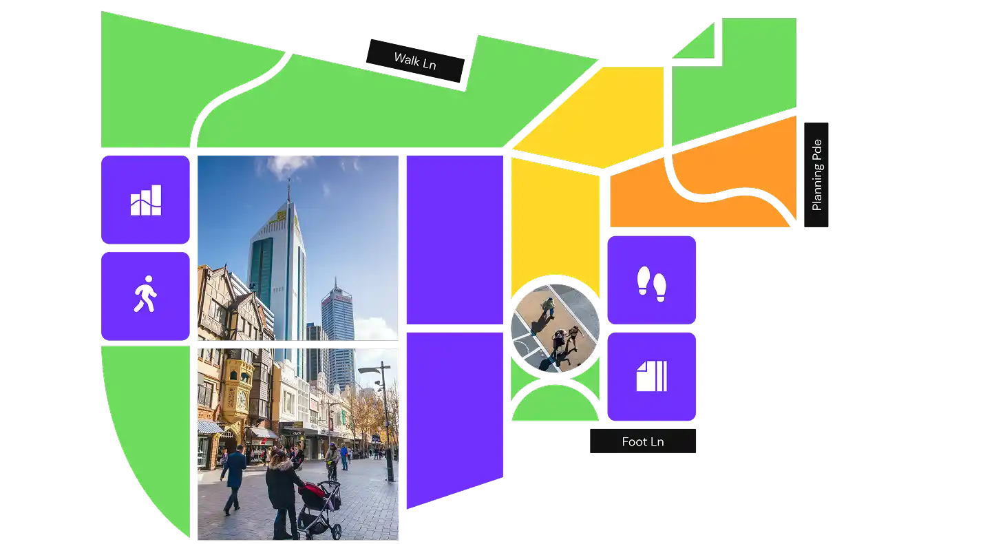
Foot Traffic Data
Get street-level insights on walk activity and pedestrian travel flows with Foot Traffic Data in Planwisely.
See how people vote with their feet
Make decisions based on where people walk using trusted pedestrian volume data and travel pattern insights.
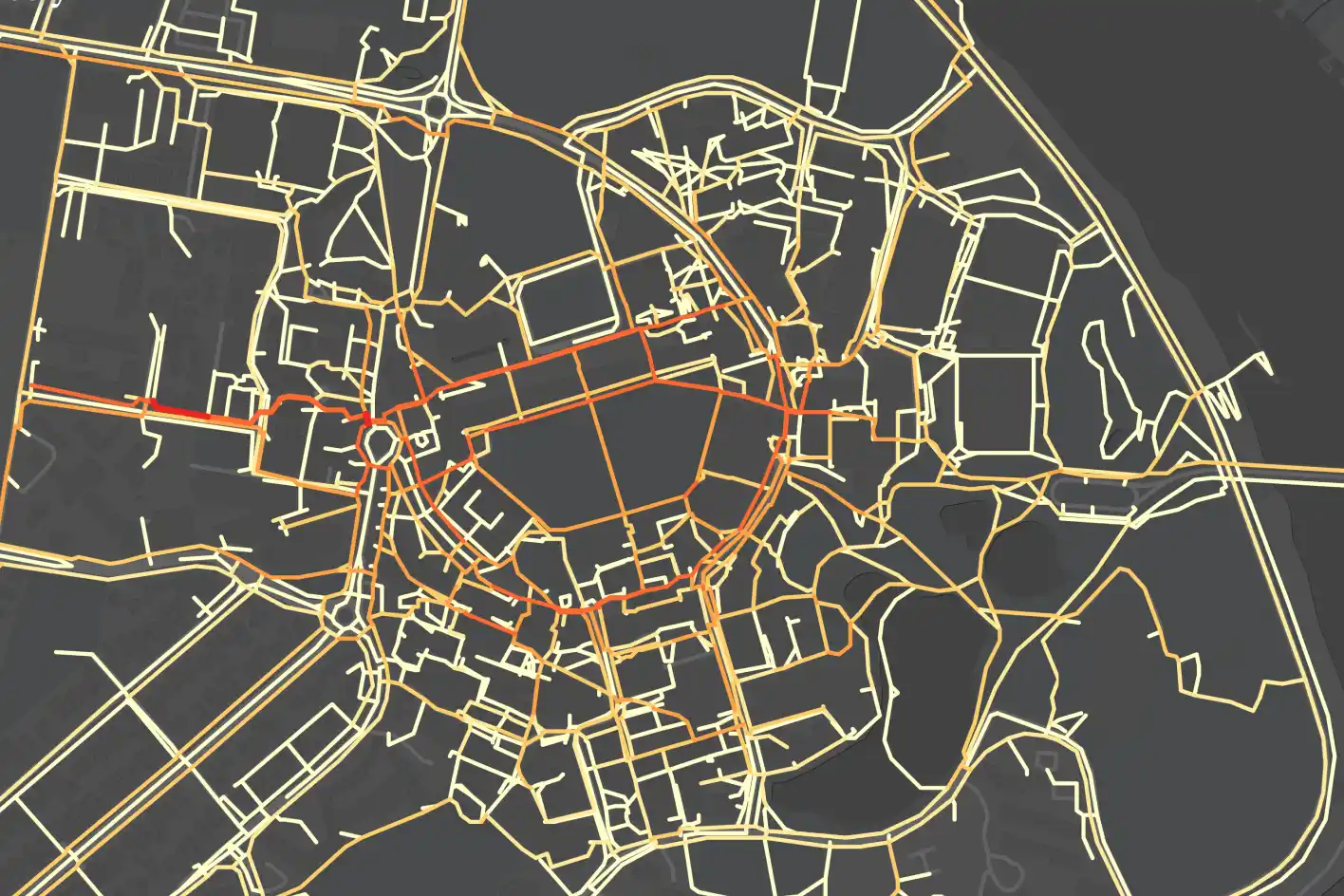
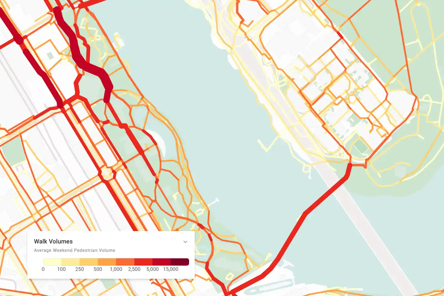
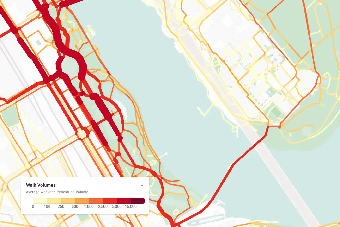
Street level foot traffic volumes
View walking volumes across the network to understand how many people choose to walk there.
Uncover pedestrian travel patterns
Investigate where pedestrians come from and go to when they use specific sections of the network.
Targeted pedestrian activity insights
Analyse individual locations based on link type and day of the week to get more granular insights.
Put your best foot forward
Planwisely Foot Traffic Data empowers you to analyse walking travel volumes and pedestrian flows at street level within Planwisely’s inuitive map-based UI.
Make better business and planning decisions by seeing how people vote with their feet
Discover hidden patterns of movement and visitation
Evaluate, compare and benchmark locations using targeted high-intent travel data
Insights backed by data tested and validated by Australia’s leading travel modelling business
Analyse walk activity across the network
Discover how many people walk on a given street or link to investigate current pedestrian activity in granular detail.
Walk volume insights help you connect place with performance, compare and benchmark different locations and interpret human behaviour by seeing how people vote with their feet.
Uncover hidden travel patterns
Reveal hidden patterns of movement and visitation by exploring how pedestrians flow through individual streets and links in the network.
Using Foot Traffic Data in Planwisely, you can visualise where people walk to or from after passing a specific location - helping you get a deeper understanding of why people travel on foot.

Highly targeted foot traffic insights
Elevate your insights by customising your analysis of how people travel on foot.
Explore targeted foot traffic volumes according to weekday or weekend activity and extract walk travel insights by percentage or total volumes.
Frequently Asked Questions
We get it, it’s a lot to take in. Here are some of the most common questions we get.
Because it is derived from GPS location events, the GPS mobility data (People Movement Data) that informs Foot Traffic Data has a uniquely high level of spatial accuracy.
To test whether it is properly representative of people's travel behaviours, VLC has undertaken extensive ground truthing research. This includes: household travel surveys (both metropolitan and regional); pedestrian hourly profiles; traffic count profiles; shopping centre visitation profiles by day of the week; National Visitor Survey research to understand tourist visitations; and stadium attendance for major events. This research has demonstrated definitive correlations between these datasets and People Movement Data in ways that support the theory that People Movement Data is a highly accurate and valuable geospatial dataset.
Planwisely Foot Traffic Data combines a wide range of place factors, network factors and travel pattern data to determine the current day walking and cycling patterns and volumes.
The PATH network is derived from the OpenStreetMap (OSM) network and then refined to create a robust, active transport-focussed network.

View walking volumes across the network to understand how many people choose to walk there.

Investigate where pedestrians come from and go to when they use specific sections of the network.

Analyse individual locations based on link type and day of the week to get more granular insights.