
Placemaking
Design well-rounded places that deliver rich experiences for the people they serve.
How Planwisely can help your project
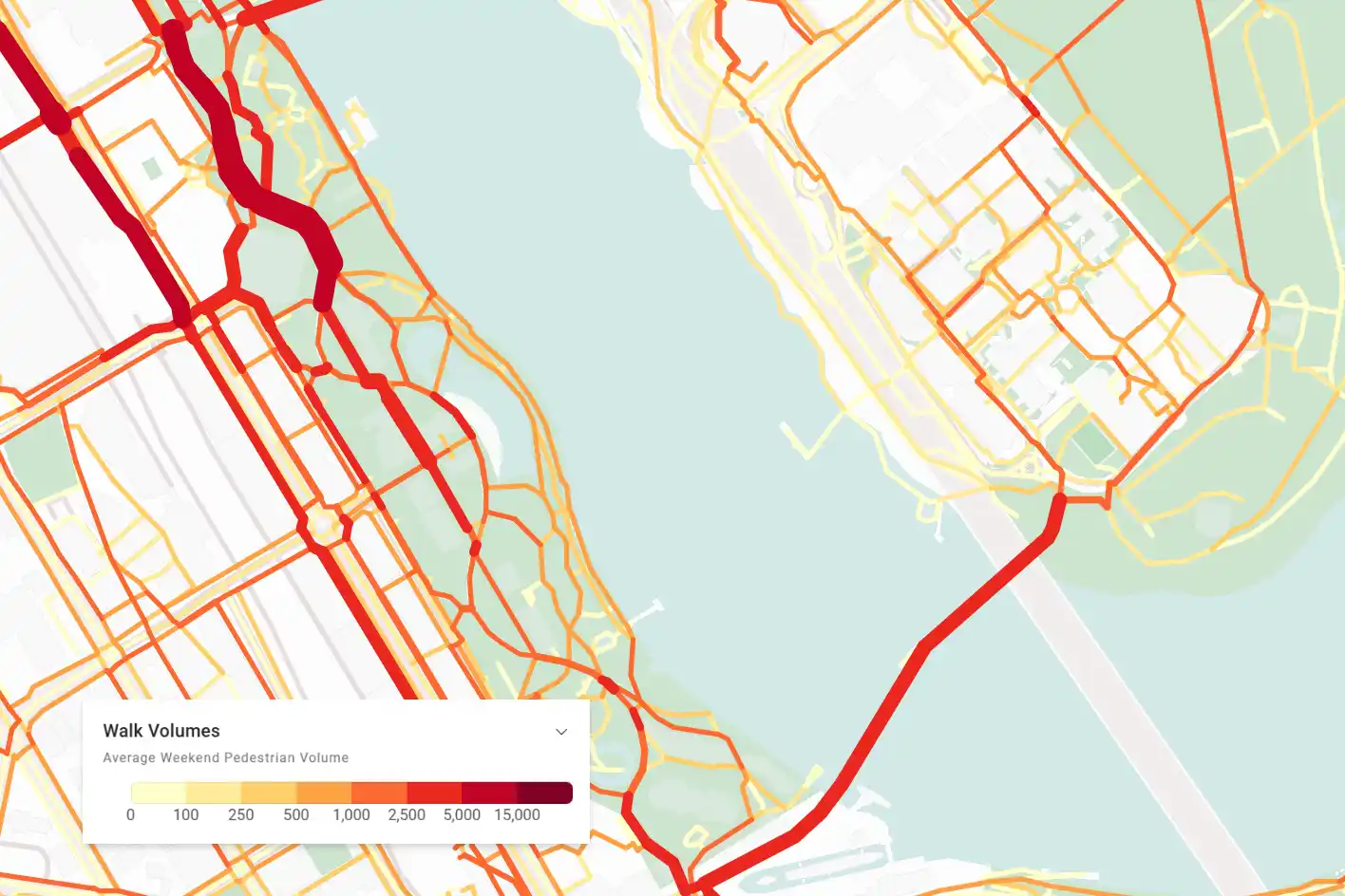
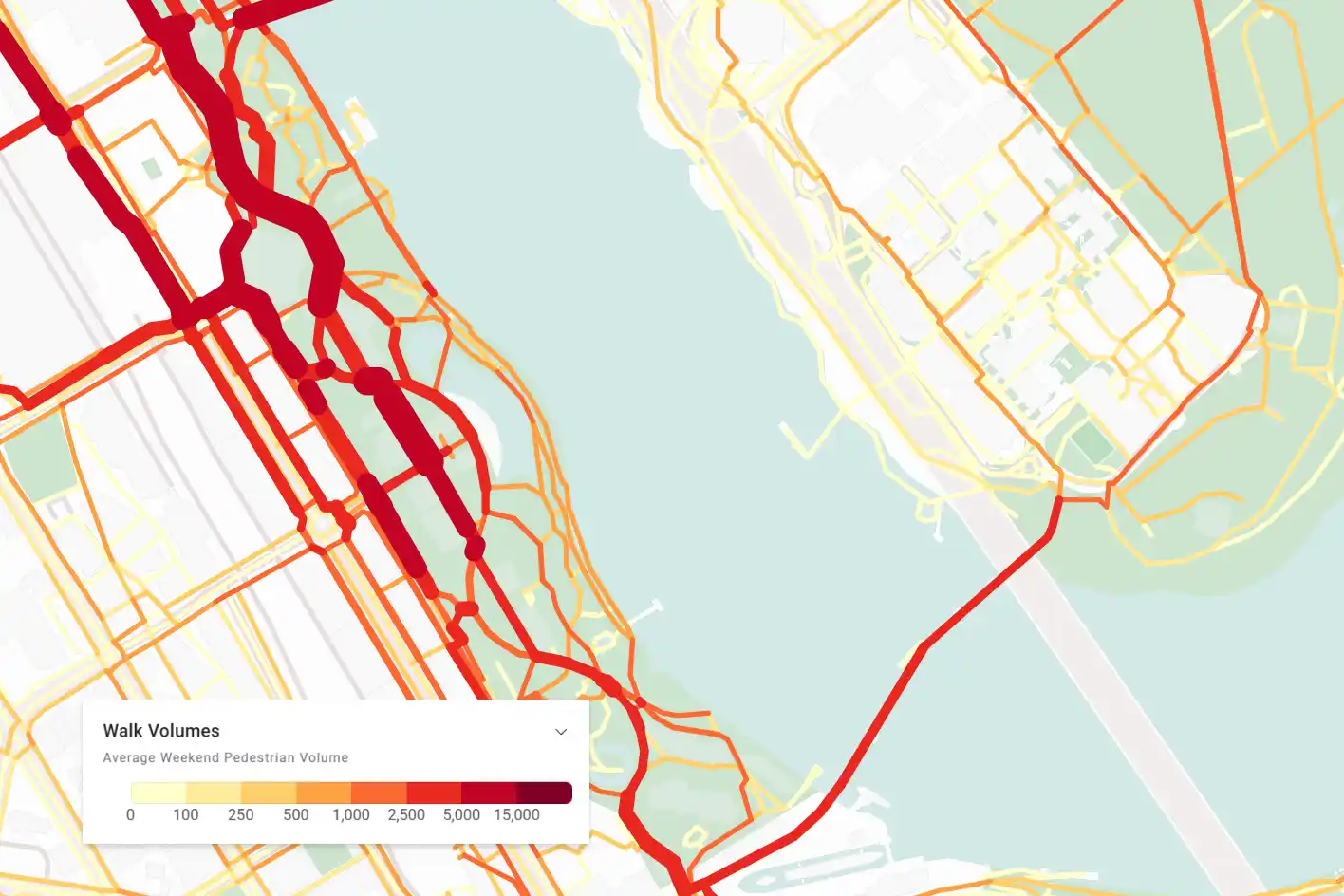
Street level foot traffic volumes
View walking volumes across the network to understand how many people choose to walk there.
Uncover pedestrian travel patterns
Investigate where pedestrians come from and go to when they use specific sections of the network.
Length of Stay
Discover when and how long people are staying in a location to measure place performance.
Drawing Tool
Bring your ideas to life with intuitive drawing tools.
Deliver better outcomes today
Planwisely’s rich geospatial library and combination of clever tools and functions make it the perfect platform for:
Placemaking frameworks
Placemaking strategies
Place audits
Master plans
Urban design strategies
Urban design frameworks
Post-implementation analysis
Highly targeted foot traffic insights
Elevate your insights by customising your analysis of how people travel on foot.
Explore targeted foot traffic volumes according to weekday or weekend activity and extract walk travel insights by percentage or total volumes.

Discover what times are the busiest
Get insights into how long people stay when they're visiting your space and identify the busiest and quietest times of day.
View length of stay and visitation peaks and troughs across the entire day, and filter that data by time of day, weekday or weekend to understand when your public space is performing at its best.

Uncover hidden travel patterns
Reveal hidden patterns of movement and visitation by exploring how pedestrians flow through individual streets and links in the network.
Using Foot Traffic Data in Planwisely, you can visualise where people walk to or from after passing a specific location - helping you get a deeper understanding of why people travel on foot.

Create a concept plan for your project
Bring your Place Vision or related project to life with intuitive drawing tools.
Create a concept plan for your project by adding shapes (2D or 3D), icons and text to the map, then instantly export it as an image to tell a dynamic story that communicates your vision for the space.


Clients using this feature

Want to get started with Planwisely?
Use powerful geospatial datasets to uncover insights, guide your decision-making process and deliver better outcomes for your project today.