Planwisely launches Road Traffic Data with nationwide coverage and journey analysis
February 24, 2026
Planwisely has officially launched Road Traffic Data, a new dataset providing a comprehensive, Australia‑wide view of vehicle movements.
We are excited to announce the launch of Road Traffic Data, a new dataset providing a comprehensive, Australia‑wide view of vehicle movements across the road network.
Designed for both public and private sector users, the dataset combines nationwide traffic volumes with link‑level journey analysis to support optimal planning, site selection, and network decision‑making.
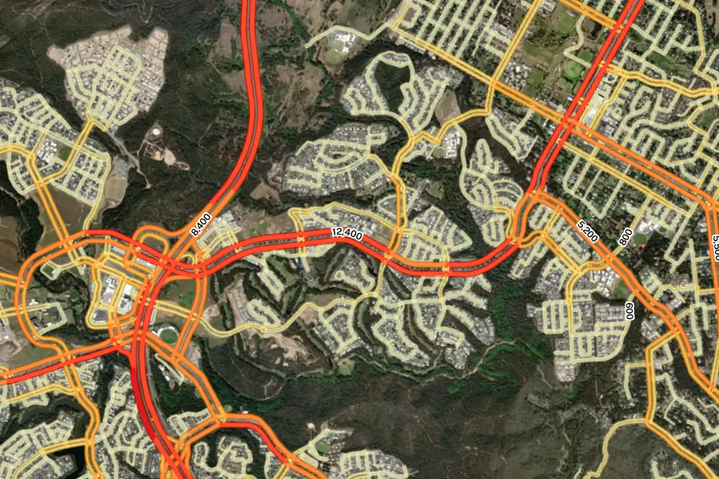
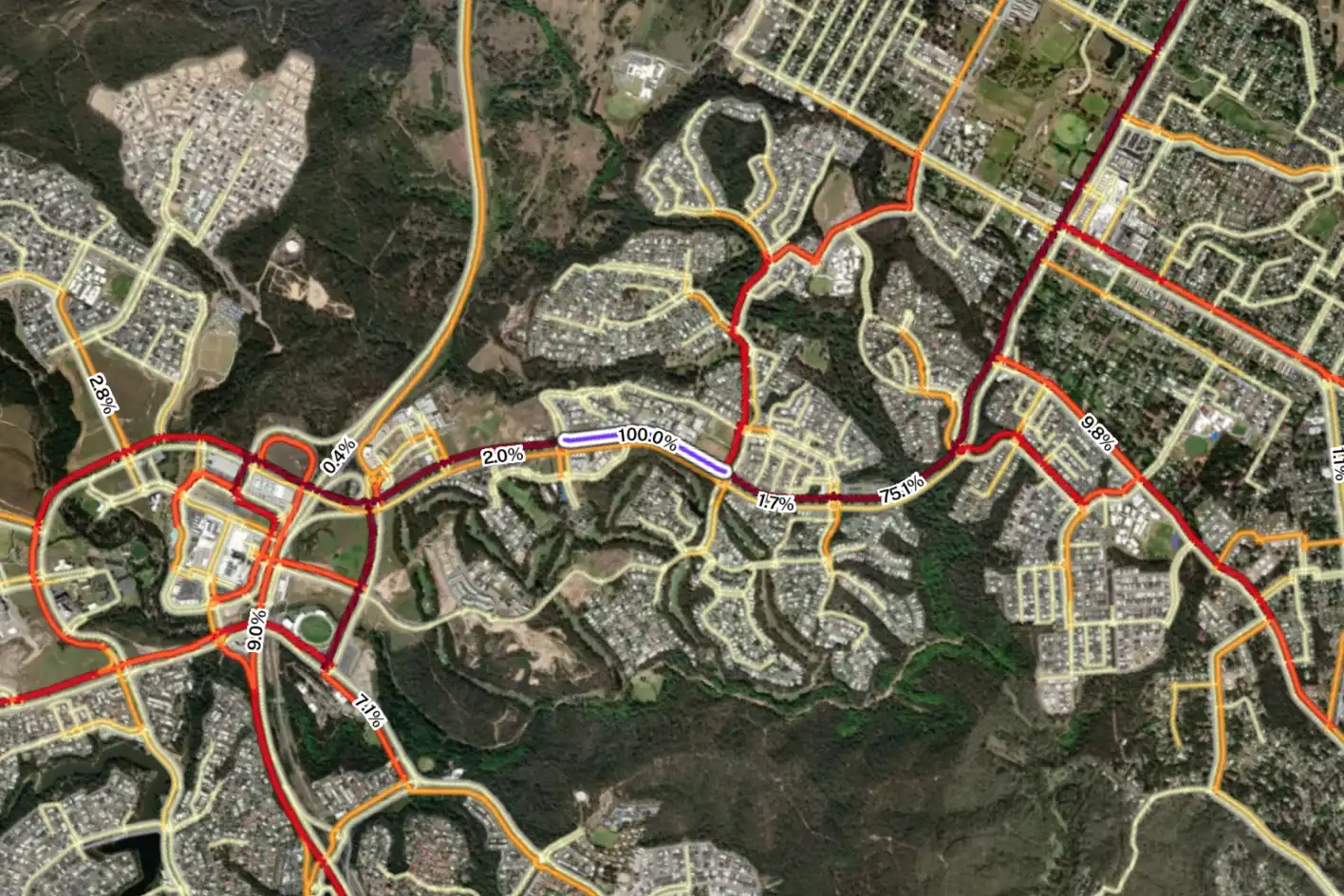
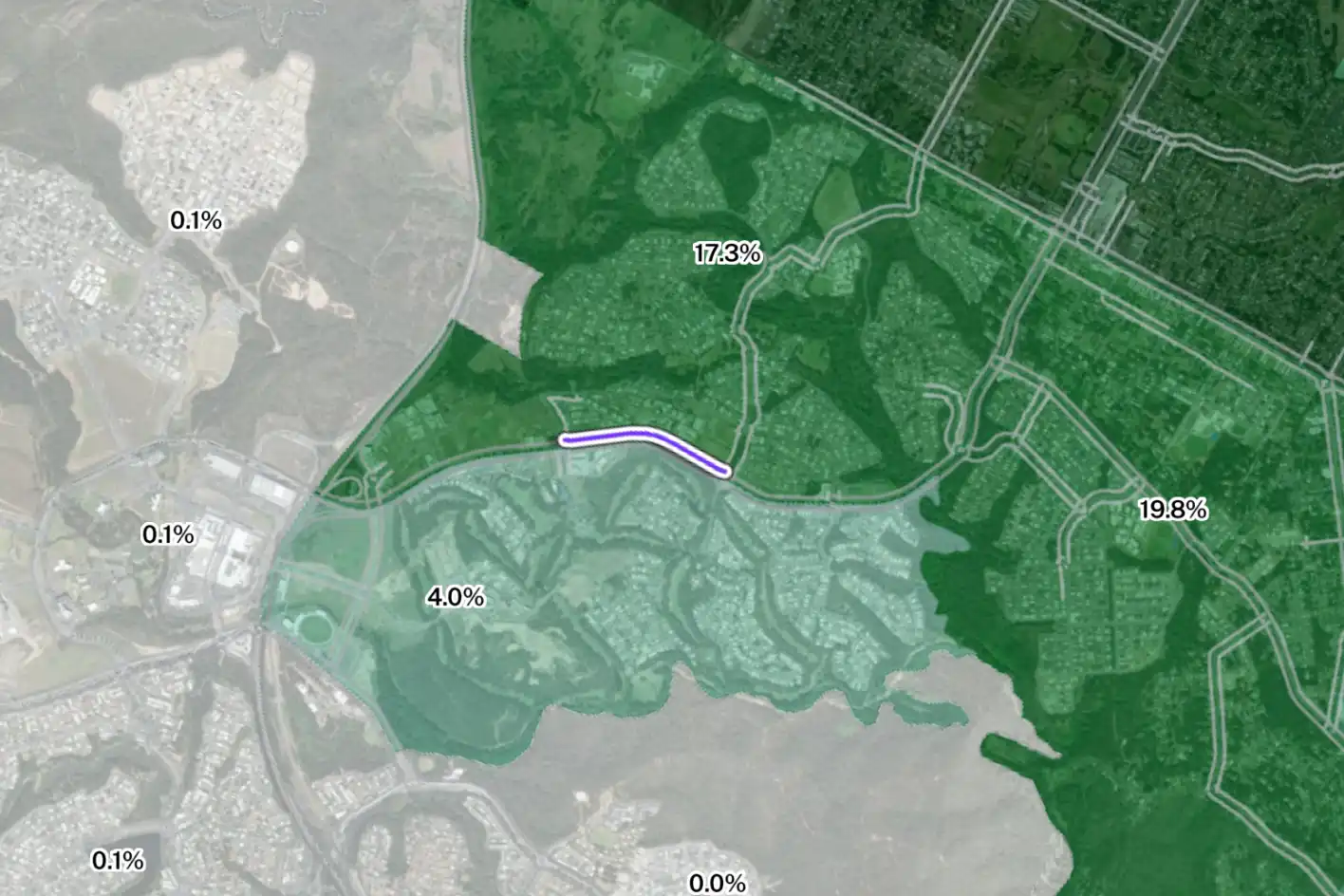
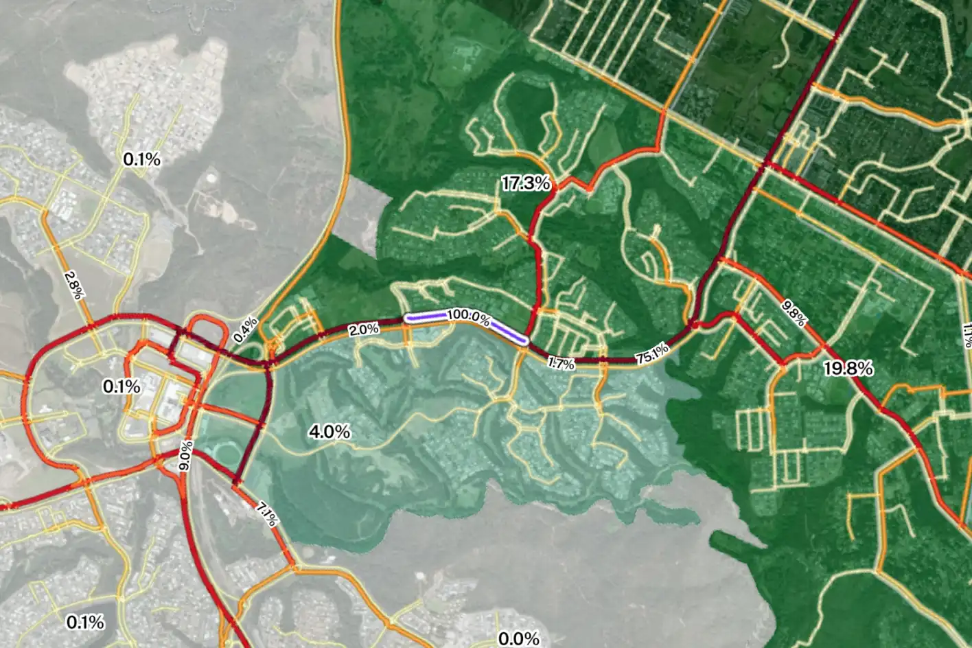
Road Traffic Data includes volumes and link-level journey analysis that also boasts origin-destination insights.
‘By combining traffic volumes with location-specific journey insights, Road Traffic Data gives planners and decision-makers a richer understanding of demand, movement patterns, and network usage at street level across the entire country,’ says Planwisely Executive Director (Digital) Ali Inayathusein.
‘Essentially, Planwisely Road Traffic Data can show analysts how roads are actually being used, not just how busy they are, and this combined level of insight is incredibly powerful.’
Unlock nationwide traffic volumes and journey insights
The dataset offers nationwide traffic volume coverage, including urban, suburban, and regional roads.
Users can flexibly analyse traffic volumes by hour(s) of the day or day type (weekday, weekend or all), as well as distinguish between total and commercial vehicle volumes. This supports a wide range of use cases, from early‑stage planning and network analysis to retail site selection and infrastructure prioritisation.
Planwisely Road Traffic Data offers nationwide traffic volumes and journey analysis by individual road segment to platform users.
A groundbreaking feature of Road Traffic Data is the ability to analyse travel patterns by road segment, which allows users to examine where vehicles come from and where they go after using a specific link in the network. This exciting addition helps distinguish local access from through‑traffic, understand catchment patterns and identify how different parts of the network interact.
Road Traffic Data is powered by large‑scale mobility data and refined using real‑world traffic counts, providing broad, consistent coverage across Australia — including locations where traditional counts may be limited or unavailable. This granular GPS data is also used to power other Planwisely datasets and tools including People Movement Data, Foot Traffic Data, Station Catchment Data and PATH, an Australia-first walk and cycle scenario planning tool.