
Site selection
Use spatial data to plan a better network and find the perfect location for your next site.
How Planwisely can help your project
Planwisely has features that make it easy to plan networks and select individual sites for retail stores, convenience and QSR, fuel, real estate development and much more.
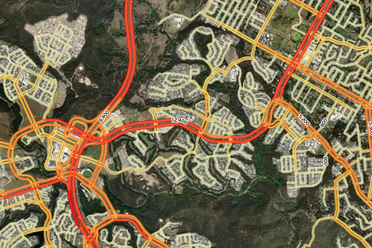
Road Traffic Data
Nationwide traffic volumes and link-level journey analysis.
Foot Traffic Data
Australia-wide walk volumes and pedestrian travel pattern analysis.
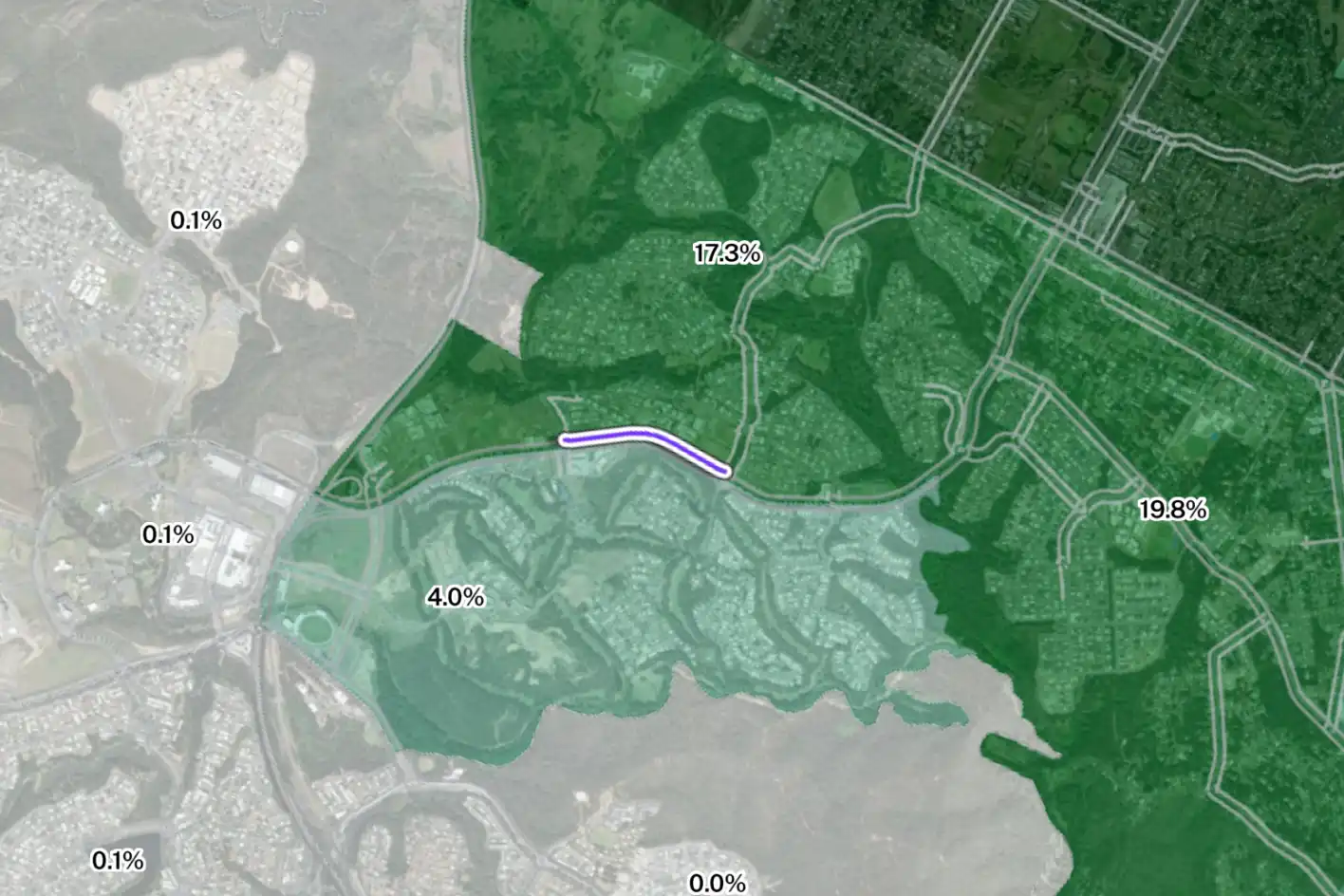
Catchment Analysis Tool
Understand accessibility and extract demographic reports.
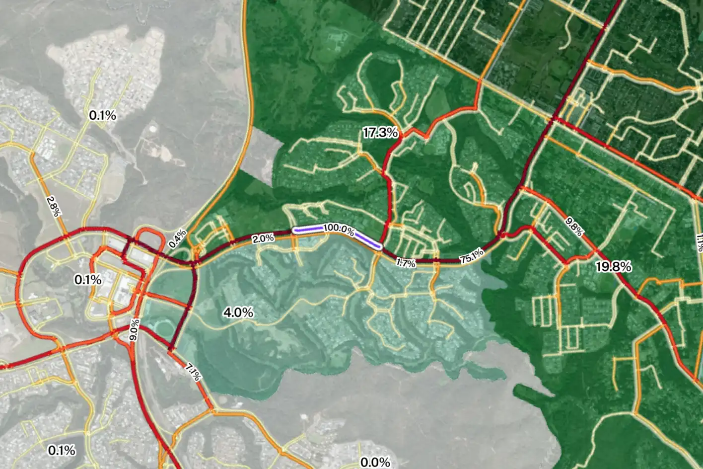
Combined Spatial Datasets
View multiple complex datasets to support your projects.
Deliver better outcomes today
Planwisely’s rich geospatial library and combination of clever tools and functions make it the perfect platform for:
Network plans
Site selection strategies
Site analysis
Competitor analysis
Gap analysis
Territory planning
Sales area mapping
Business cases
Cannibalisation analysis
Superior nationwide traffic data insights
Planwisely Road Traffic Data helps retailers, developers, and commercial teams understand where road traffic comes from, where it’s going, and when it moves.
Make site selection, network planning, and early‑stage commercial decisions definitive and defensible by combining nationwide traffic volumes with journey‑level insight across Australia’s road network.
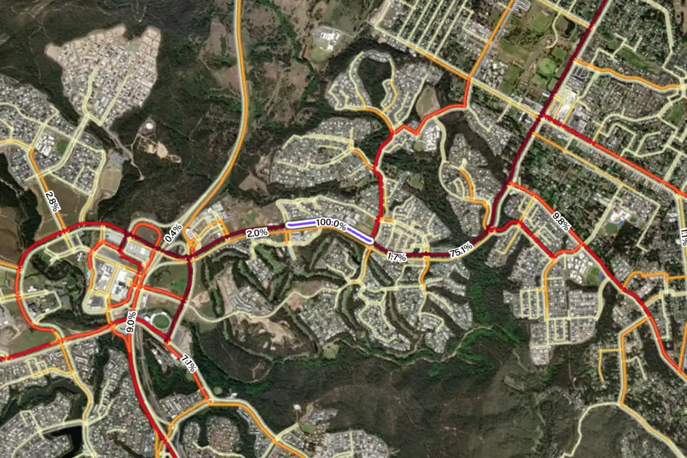

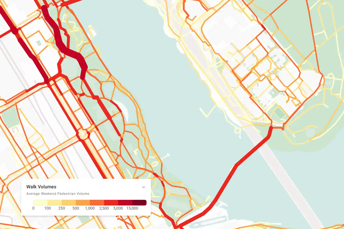
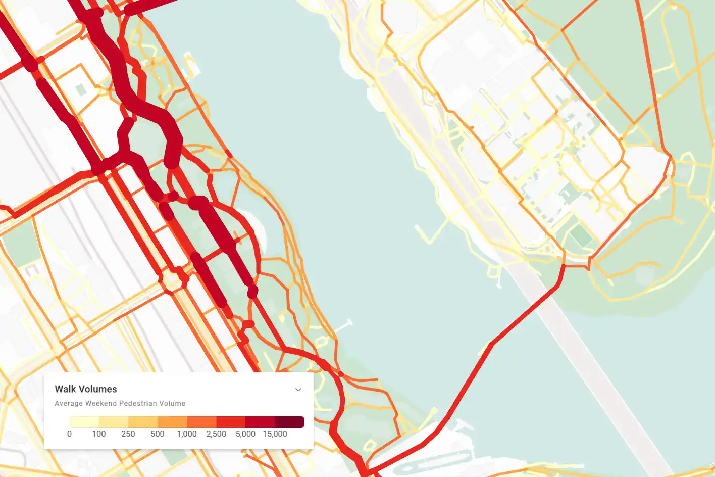
Highly targeted foot traffic insights
Elevate your insights by customising your analysis of how people travel on foot.
Explore targeted foot traffic volumes according to weekday or weekend activity and extract walk travel insights by percentage or total volumes.
Analyse your site's potential catchment
Uncover the multi-modal accessibility of your site to understand demand, perform a competitor analysis and judge the overall potential of a site.
You can then generate demographic reports to uncover even deeper insights into who your potential customers are.


View multiple complex datasets at once
Create a deep body of evidence for your site selection process or network plan by combining spatial datasets within the one map view.
Bring together land use and planning layers, store locations, points of interest, demographic and mobility data and more in one place to deliver telling insights that guide your decision making process.


Customers making better site selection decisions


Want to get started with Planwisely?
Use powerful geospatial datasets to uncover insights, guide your decision-making process and deliver better outcomes for your project today.