
Road Traffic Data
Nationwide traffic volumes and link‑level journey insights to support planning, site selection, and network decisions.
Nationwide traffic volumes and journey analysis
Nationwide traffic volumes
Traffic volumes, everywhere you need them.
Go beyond volumes
Journey analysis by road segment.
Powered by rich mobility data
Built from billions of mobile GPS data points for network‑wide insight.
What is Road Traffic Data?
Road Traffic Data gives Planwisely users a consistent, Australia‑wide view of vehicle movement across the road network.
Designed for both public and private sector use, Road Traffic Data supports planning, site selection, network analysis, and early‑stage decision‑making.
View traffic volumes across Australia’s road network
Analyse demand by hour of the day or day type
See where vehicles come from and where they go next
Gain network context for planning and location decisions
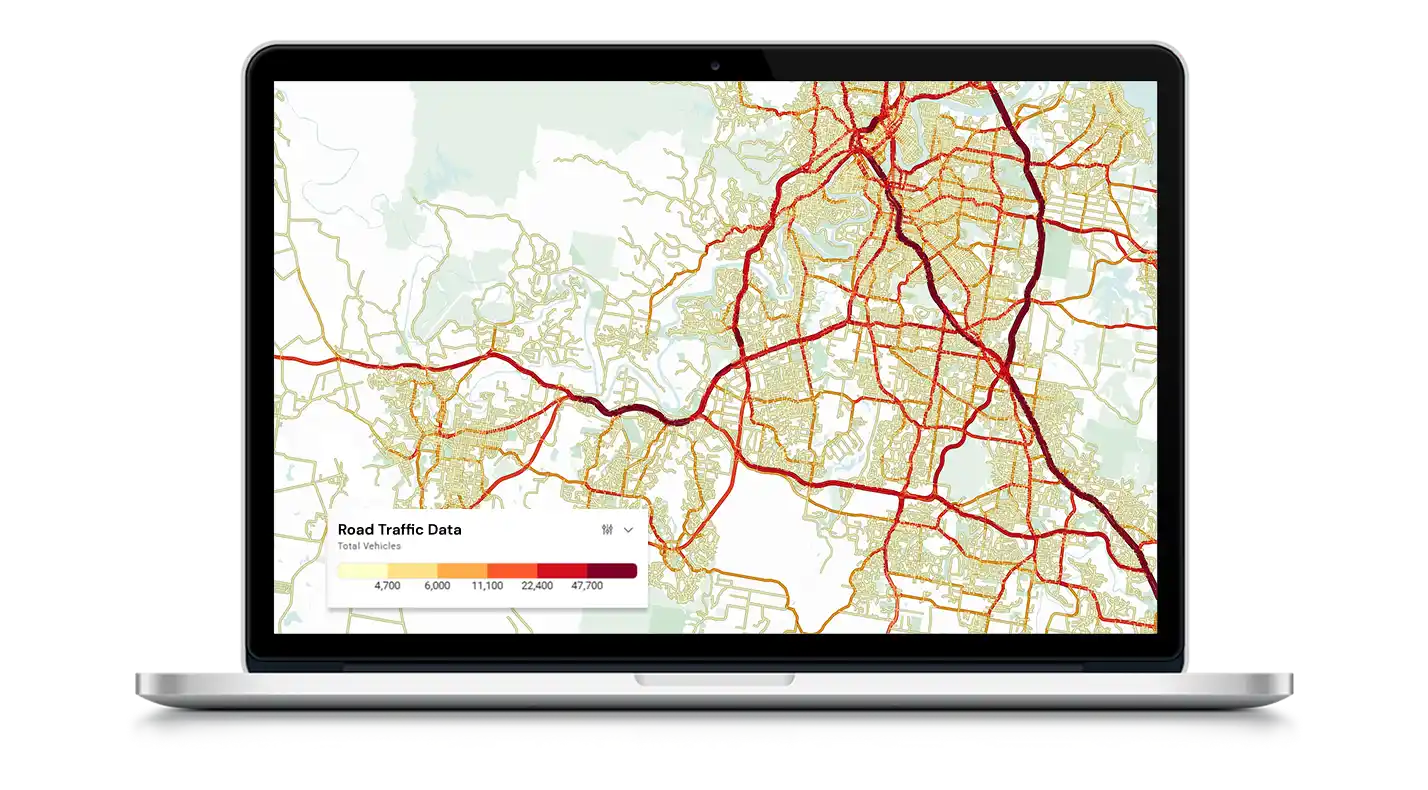
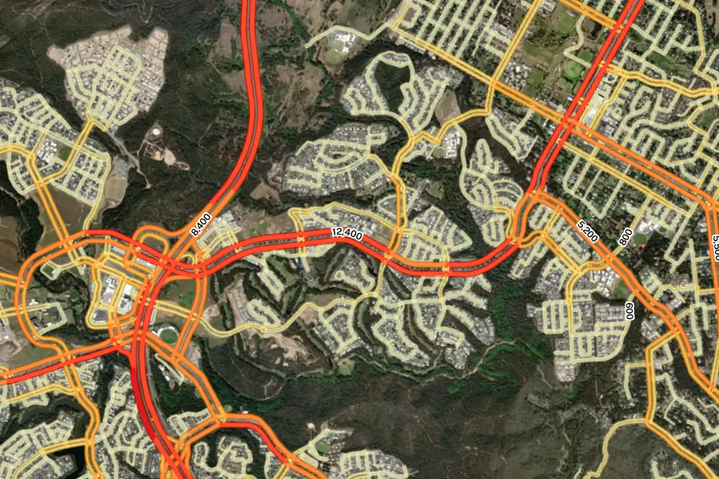
Nationwide traffic volumes
View average daily traffic volumes at a link level across Australia to understand relative demand, exposure, and network usage.
You can also analyse volumes by hour of the day, weekday or weekend activity, as well as total or commercial vehicle volumes – so you can find the exact insights you need.

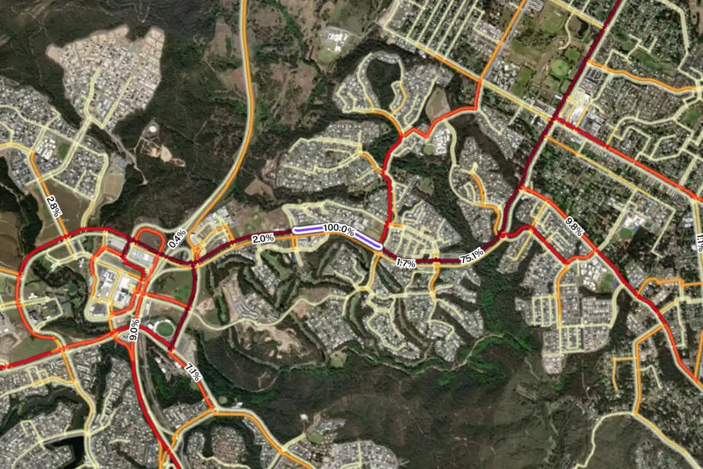
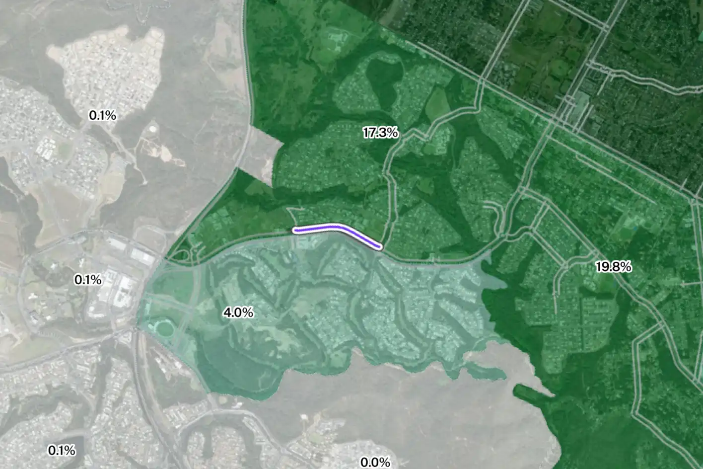
Go beyond volumes with journey analysis
Understand how individual road segments are actually used – not just how busy they are.
Analyse where vehicles come from, where they go next, and when they travel throughout the day to identify local access versus through traffic, catchment areas, trip purpose and more to gain deeper insight into movement patterns and network behaviour.
Powered by rich mobility data
Planwisely Road Traffic Data is built from billions of mobile GPS data points and refined using thousands of real‑world traffic counts, giving you granular and reliable coverage across Australia.
Make decisions based on observed movements instead of assumptions with access to network-wide insights within Planwisely’s intuitive map-based interface.

Frequently Asked Questions
We get it, it’s a lot to take in. Here are some of the most common questions we get.
Planwisely’s Road Traffic Data is built using anonymised mobile device data combined with a high‑quality national road network.
GPS events are grouped into complete trips and scaled to represent the wider travelling population. These trips are then accurately assigned to the road network using advanced spatial processing techniques, including robust handling of complex environments such as tunnels.
Before traffic volumes are finalised, a multi‑stage calibration process uses observed traffic counts collected by transport agencies. This calibration draws on traffic count data from thousands of locations nationwide and ensures volumes are consistent across road types, times of day, weekday and weekend patterns, and vehicle types. Where available, calibration is applied at both average daily and hourly levels.
Finally, rigorous quality checks remove implausible or distorted trips, ensuring the resulting traffic volumes are robust, consistent, and suitable for planning, analysis, and decision‑making.
Planwisely Road Traffic Data volumes are validated using observed traffic counts collected by transport agencies across Australia. These counts are used to assess how closely traffic volumes reflect real‑world conditions across different regions, road types, and traffic environments.
Validation is carried out at both average daily and hourly levels, with weekday and weekend patterns assessed separately. This ensures traffic volumes not only match observed totals, but also represent realistic time‑of‑day behaviour on the road network.
Together, this approach provides confidence that Planwisely Road Traffic Data delivers reliable, consistent traffic volumes suitable for planning, analysis, and decision‑making.

Traffic volumes, everywhere you need them.

Journey analysis by road segment.

Built from billions of mobile GPS data points for network‑wide insight.