
Simple, powerful place-based analytics
A truly intuitive location intelligence platform for turning geospatial data into actionable insights.


Built for Australia's planners and real-world decision makers
Planwisely helps teams move beyond assumptions by turning complex spatial data into clear, defensible insight for real planning and site decisions.
So, what project are you working on?


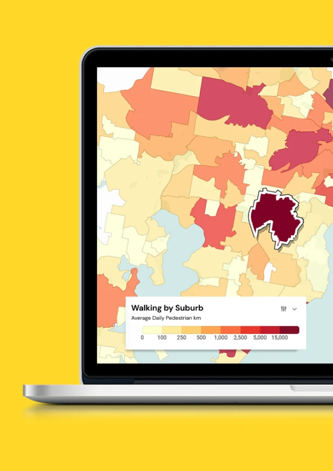
Planwisely Data Report: Australia's Top Walking Suburbs
Trusted by leading planners and decision makers


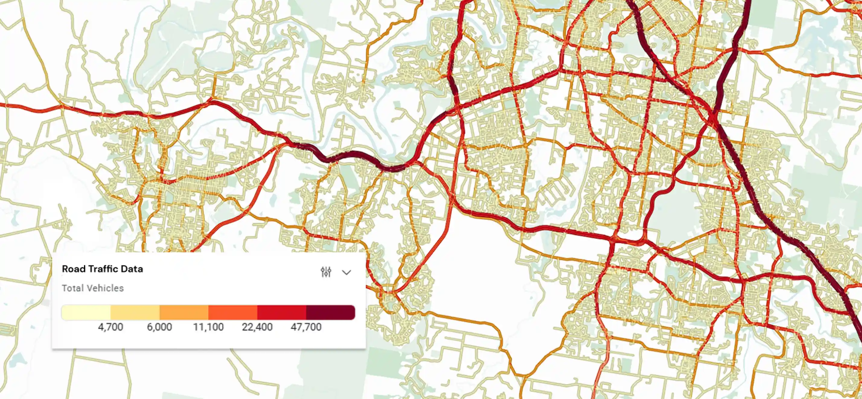
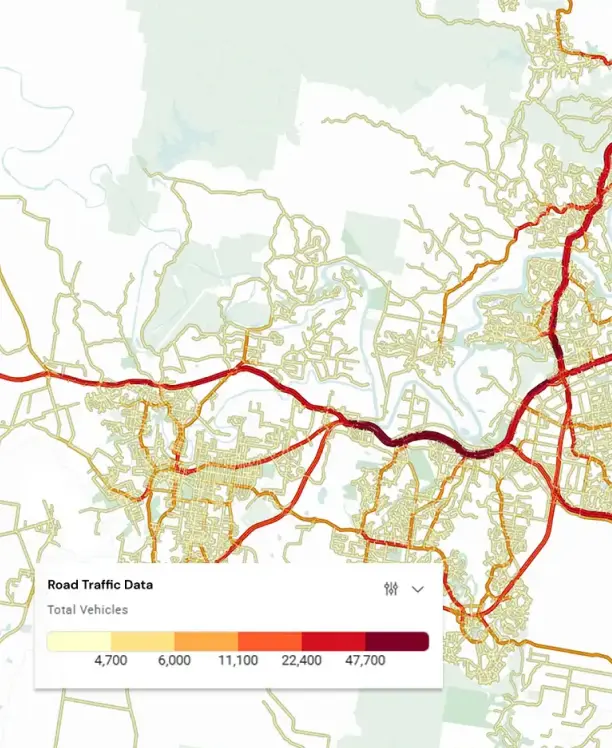
Road Traffic Data in Planwisely
Our latest insights

Article
Article
Where Australians Actually Walk: The Top Suburbs Revealed
Article
New data reveals where Australians actually walk the most. Explore the top walking suburbs nationwide and download the full report.

Bayside City Council
Case Study
Bayside City Council needed quick access to movement and accessibility data insights for their open space assets to understand how they are being used and make evidence-based planning decisions.
Case Study
Case Study


Want to get started with Planwisely?
Use powerful geospatial datasets to uncover insights, guide your decision-making process and deliver better outcomes for your project today.