Let’s break down the essential components of a council walkability assessment, why each one matters and how to streamline the process.
Walkability is more than a buzzword – it’s a measurable, actionable way to improve community health, safety, and connectivity.
For local governments, walkability assessments are becoming a cornerstone of active transport planning and a key requirement for securing infrastructure funding. But what exactly goes into a walkability assessment, and how can councils complete one efficiently?
At its core, walkability is the measure of how accessible an area is for walking (or using a mobility aid).
What is a walkability assessment?
A walkability assessment evaluates how easy, safe, and practical it is for people to walk in a given area. It helps councils understand:
How well key destinations are connected by foot
Where infrastructure gaps or safety issues exist
Which areas have high pedestrian demand
How walkable environments support broader planning goals
These assessments are often required (or strongly encouraged) in infrastructure grant applications, particularly those focused on active transport.
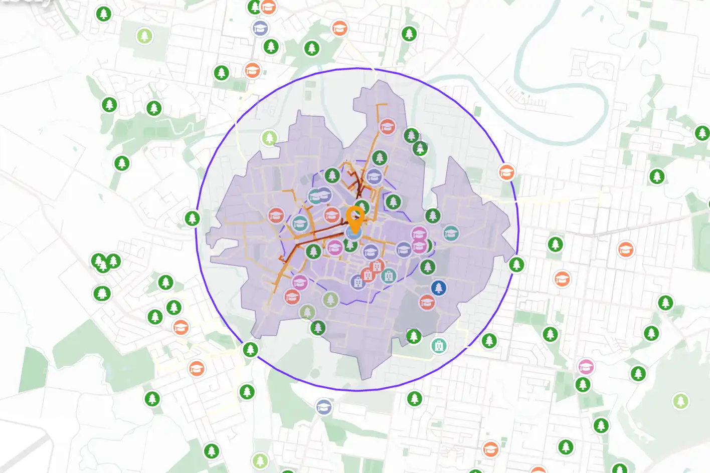
A map in Planwisely that depicts numerous elements required for a walkability assessment (including walk catchments, trip attractors and pedestrian movements) which are essential for understanding community needs and building a compelling case for funding.
What should be included in a walkability assessment?
A robust walkability assessment combines spatial data, safety insights, and demographic context to give councils a clear picture of how walkable an area is – and where improvements are needed. Here’s what to include:
Assess walkability in your council with Planwisely
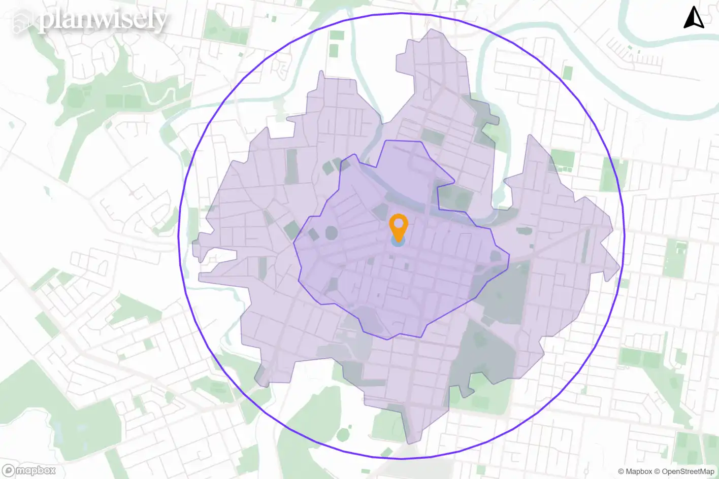
Catchment mapping shows how far people can walk from a given location within a reasonable timeframe or distance— typically 10 to 20 minutes or 1km to 2km. These maps help councils understand which areas are well-connected and which are isolated or underserved.
Understanding walk catchments helps identify missing links, severance (such as major roads or rail lines), and physical barriers, helping councils understand where connectivity breaks down. These insights are essential for planning new paths, crossings, or upgrades.
Why it matters:Catchment analysis is especially important when planning infrastructure near schools, transport hubs, or retail centres. It also aligns with funding criteria that often require proximity to public transport or key destinations.
A 2km radial catchment and 1km and 2km walking catchments around an activity centre.
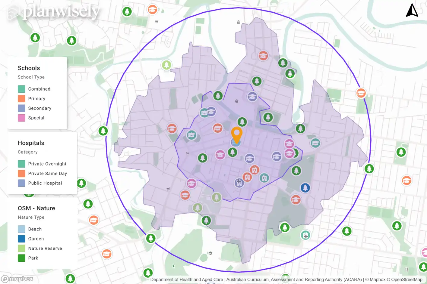
Trip attractors
Trip attractors are destinations that generate pedestrian activity — such as schools, parks, shops, medical centres, and community facilities. Mapping these helps councils understand where people are likely to walk and where infrastructure should be prioritised.
Why it matters: Funding bodies want to see that proposed infrastructure will serve real demand. Identifying trip attractors helps justify investment and ensures projects are community focused.
Knowing where and how many trip attractors lie within your catchment areas can help prioritise planning efforts.
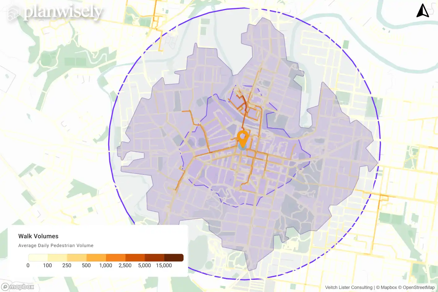
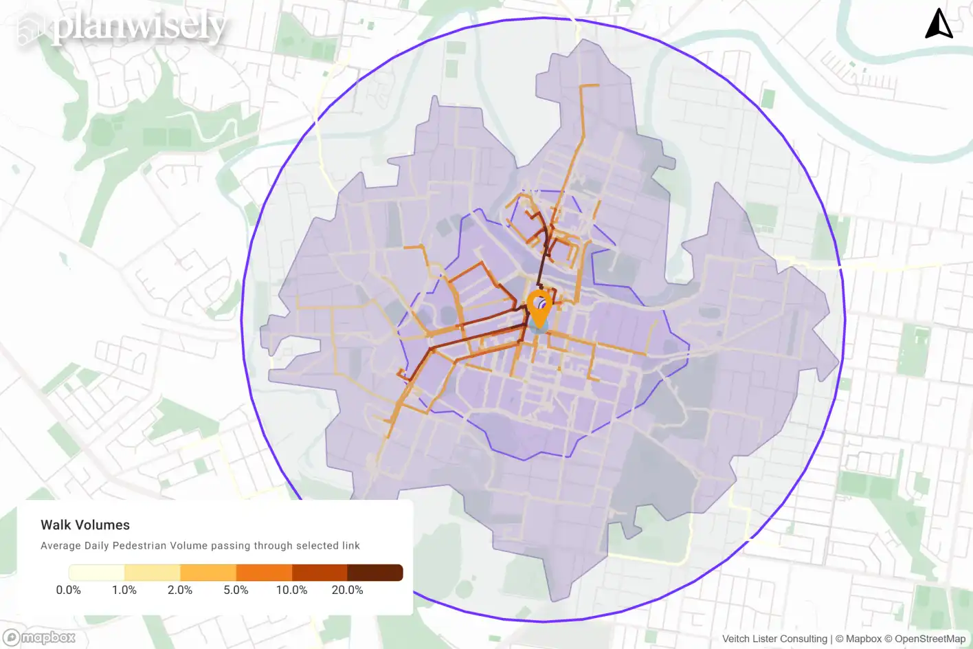
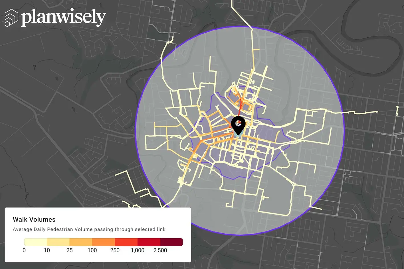
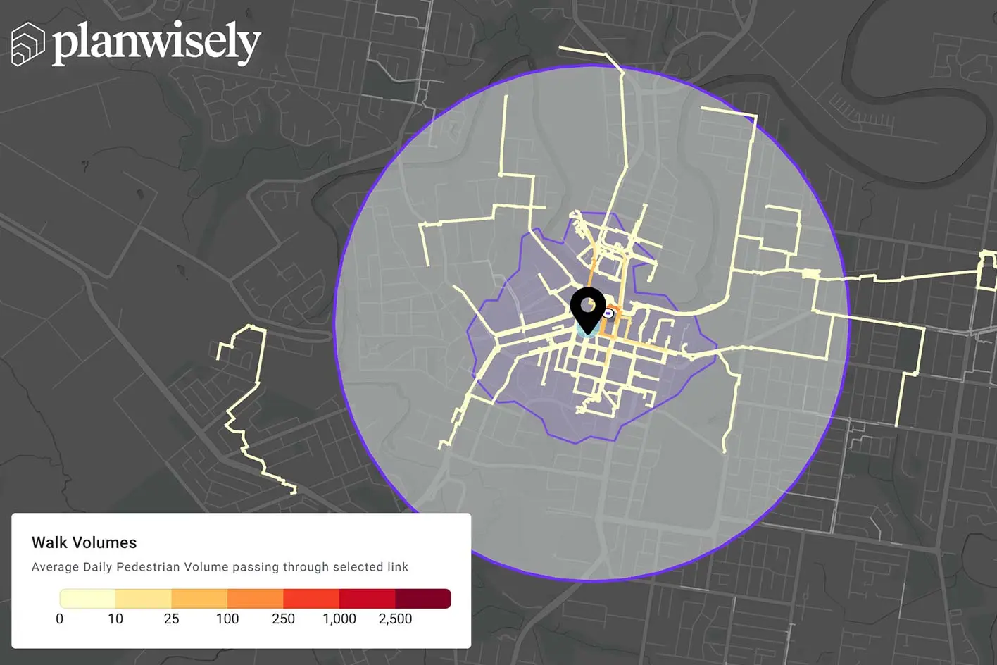
Pedestrian volumes and trip patterns
Understanding how many people walk along specific street segments — and where they go before and after — is crucial for assessing demand and designing effective interventions. Link-level foot traffic volumes provide granular insight into how different parts of the network are used, especially in high-activity areas like main streets, town centres, or transport corridors.
Knowing how many people walk in a given area and where they tend to travel is critical information, both for walkability assessments and proceeding infrastructure grant applications.
Why it matters: Many funding programs require councils to demonstrate pedestrian demand. But beyond raw counts, understanding trip patterns — such as the percentage of people who walk through a high street and continue to nearby schools, shops, or stations — helps councils prioritise upgrades that support real-world movement. It also reveals how infrastructure changes might influence broader walking behaviour.
Overall walk volumes (left) and where people walk to and from after walking through the selected activity centre (right) can be used to understand demand, as well as spot gaps or deficiencies.
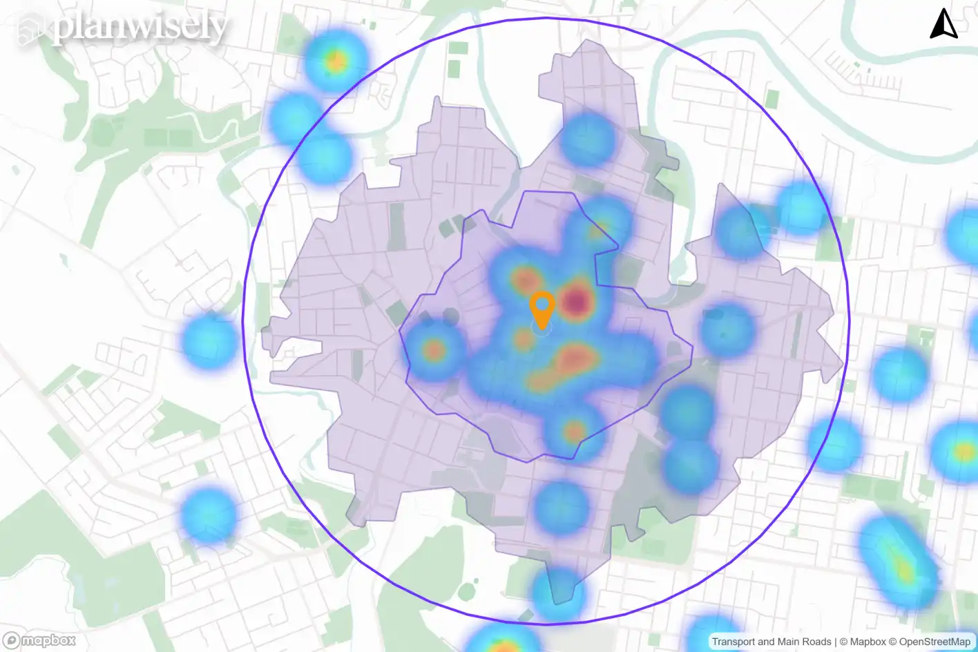
Pedestrian crash data
Safety is a core component of walkability. Analysing crash data involving pedestrians helps councils identify high-risk areas and plan interventions like crossings, speed reductions, or traffic calming.
Why it matters: Demonstrating a safety need strengthens funding applications and helps councils target improvements where they’ll have the greatest impact.
A heatmap of motor vehicle crashes involving pedestrians within the last five years, which can demonstrate a need for investment.
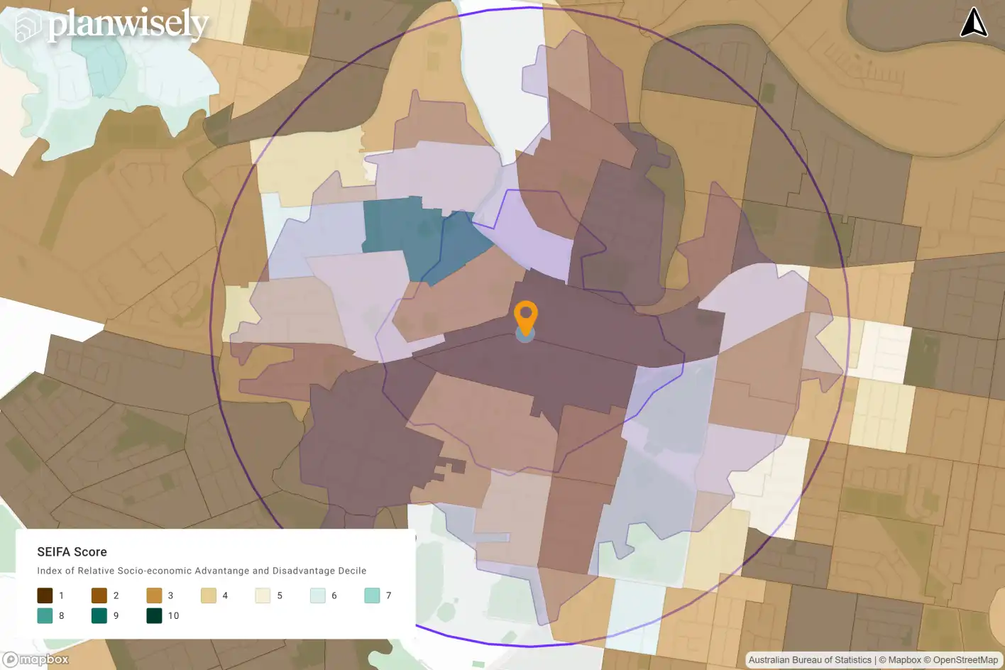
SEIFA and demographics
Walkability should serve all residents, especially those who rely on walking as a primary mode of transport. Including socioeconomic and demographic data ensures planning is inclusive and equitable.
Why it matters: Funding bodies increasingly prioritise projects that support vulnerable or underserved communities. This includes people who experience economic disadvantage and residents under 18 or over 65; SEIFA and demographic overlays help councils align with these goals.
Socio-Economic Indexes for Areas (SEIFA) ranks areas according to their relative socio-economic advantage and disadvantage using Census data.
Why walkability assessments lead to better plans (and more funding)
A well-executed walkability assessment doesn’t just inform good planning — it strengthens funding applications.
State governments increasingly expect councils to demonstrate:
Strategic alignment with walking and transport goals
Evidence-based prioritisation
Community benefit and equity
Safety and demand justification
Walkability assessments serve a crucial purpose in planning better places backed by evidence-based insights.
So, whether you're hoping to get a preliminary understanding of an area or you’re applying for infrastructure funding, a walkability assessment is your foundation.
Planwisely's Link Analysis tool can be used to identify primary and secondary walking routes like the council map (second slider image) above.
Ready to get started?
Whether you're preparing a grant application or updating your strategic plans, Planwisely gives you the tools to assess walkability with confidence.
Assess walkability in your council with Planwisely


.jpg)


